Turtles sun themselves on mossy logs. A Great Blue Heron, perched on spindly legs, seems deep in a reptilian slumber, until I notice alert, ink-black eyes staring into the murky canal slurry. It darts its head below water, and emerges with a fish flopping in its beak. Spindly legs remain planted and have not moved from their perch in the pea green sludge.

A fawn, still speckled and furtive, stares me down from the middle of the path. She darts her head to the left and the right, unsure which direction to retreat. She chooses the river. Leaping over brambles and boulders, in an instant white spots blur to white tail, and then nothing.
The canopy opens.
I am in a clearing, the sun beats down on wildflowers and red crested sumac. Above the canal, on a mountain made of slag, the carcass of a wire factory looms. Chemical distilleries and petroleum tanks. An enormous blast furnace's mouldering hull.
For hours previous, my sylvan idyll was interrupted only by the ruin of an occasional sandstone canal lock, lichen crusted and mossy, or an old iron bridge trestle, picturesque with rust. Now, looming before me, suddenly, the dregs of the Industrial Era. I find myself, after 37 languid miles, engulfed in Cleveland's Industrial Valley.


My journey along this old river, my river, this winding Cuyahoga, is full of surprises.
My hometown's eponymous river has a reputation that precedes me.
In 1969 she burned. A conflagration that lasted just 30 minutes, it was extinguished without much fanfare, perhaps because it wasn't the first time. 1868, 1883, 1887, 1912, 1922, 1936, 1941, 1948, and 1952 also brought flames to the thick oily sludge the river became once it reached Cleveland.
In my travels, my hometown's namesake sometimes got a funny reaction. Cuyahoga? Isn't that where the river burned?
A lifetime of that barb perhaps made me defensive.
My prose turns downright purple when I describe her craggy cliffs, her mossy glens, her silver barked beech trees, stretching sinewy arms to a cerulean sky, anchored to a tenuous steep sandstone foundation, flecked with lucky rocks.

I explain to people, my part of the river, upriver, is where she bends, at the great gorge, and cascades in virile cataracts through sandstone canyons. She then makes a sharp turn north, to eventually dump into Lake Erie, just thirty miles from her headwaters after a meandering 100 mile course.
But all they know is the burn.
I have paddled her headwaters at Hiram.
I have searched her source in Geauga County.
When I was away from her, I felt the primeval need to dip my toes in her sweet, oleaginous waters whenever I returned.

I know, in quite deep particularity, her shores and her islands, at her massive bend here at Summit County, her highest point, the base of her "U."
But, in all these travels, I have never traced my river to her destination. I had never seen where the mouth of my river meets the placid Erie shore.
So on this day, halfway through my fortieth year, I set out to see where the river burned, on a 1977 French Motobecane racing bike, perpetually stuck in low gear.
I start at that old beauty spot, the Prospect Street Bridge, above the Highbridge Glens, where Victorian ladies in bustles descended to amble along picturesque riverside trails, and mustachioed gentlemen trolleyed in for a day's excursion. They marvel in sublime awe at sandstone caverns. Otherworldly ice formations drip from steep ravine walls.

By my earliest memories, at our nation's Bicentennial, it was just machine shops and old rusty turbines, auto dealers and parts stores perched atop those canyons walls, with barely a hint of what lay below. I remember the old Glens restaurant, dark leather booths and special steak dinners. I assumed it was named after some guy, Glen.
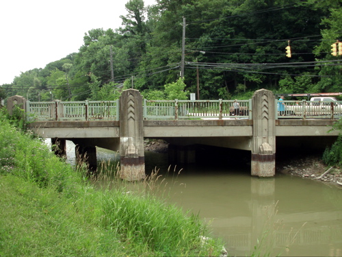
Along the lip of the Gorge I continue, past rows of postwar houses. At Babb's Run I begin the descent, down North Hill to Merriman Valley. This is where things bottom out, the rest of the journey is flat, along the towpath, where mules once trod.

Through the old Western Reserve villages of Peninsula and Boston and Brecksville, Greek Revival farmhouses and bank barns, old mossy canal locks and rusting steel bridges, portend the industrial ravages ahead.
 |
| Boston Store, circa 1836. |
 |
| Stanford Farm Bank Barn, circa 1830s |
 |
| Deep Lock, Peninsula, Ohio |
 |
| Alexander Mill, at Valley View, circa 1852 |
 |
| 1888 steel trestle bridge, spanning the Cuyahoga, at Brecksville, built in Massillon, Ohio. |
And, everywhere, the bridges, dwarfing you at Stumpy Basin, looming at Boston Mill, positively Brobdingnagian at I-480. This old river, meandering and languid though she seems, carved herself a chasm, deep and wide.
 |
| Brecksville Viaduct |
 |
| I-480 overpass |
 |
| Art Deco canal overpass, at Valley View. |
 |
| Shortline Trestle, Cleveland. |


Someone once said, do something new every day. If you've lived beside the bend of a river all of your life, and never thought to trace its course to that place where it ends, this might be the day. You might find yourself in an unexpected place, the place where the river burned.
No comments:
Post a Comment